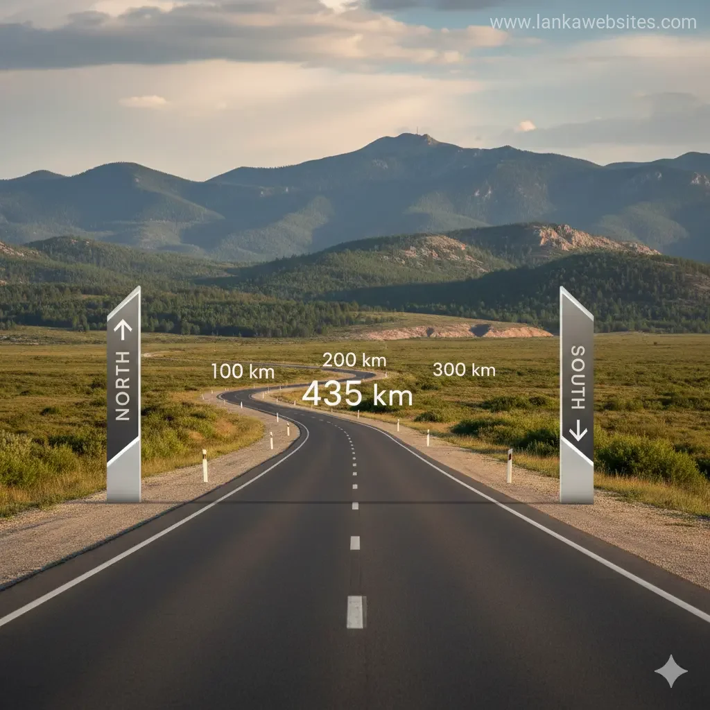
The Distance from North to South Is Only 435 km
Imagine waking up to the misty hills of Nuwara Eliya in the morning, sipping tea from the country's highest plantations, and by evening, dipping your toes into the warm sands of Mirissa beach on our s
The Lankawebsites editorial team curates, fact-checks, and updates guides on personal finance, property, health, immigration, legal, business, and lifestyle topics relevant to Lankawebsites readers. Articles are produced with AI assistance and reviewed by the editorial team before publication.
Imagine waking up to the misty hills of Nuwara Eliya in the morning, sipping tea from the country's highest plantations, and by evening, dipping your toes into the warm sands of Mirissa beach on our southern coast. That's the magic of Sri Lanka – the distance from north to south is only 435 km, making every corner of our island accessible within a day's journey. Whether you're a local planning a weekend getaway or simply curious about our compact paradise, this astonishing fact opens doors to endless adventures right here at home.
Why 435 km Matters: Sri Lanka's Compact Size in Numbers
Our pear-shaped island stretches just 435 km from Point Pedro in the north to Dondra Head in the south, with a maximum width of 240 km from east to west. This totals a land area of 65,610 sq km, smaller than many provinces elsewhere but packed with diversity that rivals continents. For us locals, this means you can drive from the Jaffna peninsula's cashew groves to Galle's historic forts without needing a passport or a week off work.
In 2026, with improved roads like the Southern Expressway and ongoing upgrades to the A9 highway, travelling these 435 km has never been easier or safer. The Department of Highways reports average speeds of 80-100 km/h on expressways, cutting Colombo to Matara to under 2 hours. It's a reminder that our island's size fosters connectivity – no place feels truly far.
Exact Measurements and Coordinates
- North-South Length: 435 km (270 miles), from Point Pedro (9°50′40″N) to Dondra Head (5°55′08″N).
- East-West Width: 240 km (149 miles) at widest, though some measures note 225-226 km.
- Coastline: Approximately 1,600 km, giving us beaches galore despite the compact interior.
- Population: Around 21.75 million in 2025 estimates, yielding a density of 327 people per sq km – bustling yet breathable.
These figures, confirmed across official and geographical sources, highlight why Sri Lanka punches above its weight in natural wonders and cultural gems.
Journey from North to South: A Road Trip Guide for Locals
Planning to experience the distance from north to south is only 435 km firsthand? Here's a practical itinerary using public transport, private cars, or trains – all budget-friendly for Sri Lankan families.
Northern Highlights: Starting at Point Pedro
Kick off at Sri Lanka's northernmost tip, just 435 km from the south. Jaffna's libraries, temples like Nallur Kandaswamy Kovil, and fresh seafood markets await. In 2026, the revamped Palaly Airport makes access simple, with direct flights from Colombo in under an hour.
- Drive Time to Colombo: 6-7 hours via A9 (400 km).
- Train Option: Yal Devi Express, scenic and affordable at LKR 1,500-2,000 one-way.
- Tip: Stock up on Jaffna crab curry – a northern delicacy you'll miss down south!
Central Highlands: The Heart of the 435 km
Halfway down, the central highlands rise dramatically. Kandy's Temple of the Tooth, Nuwara Eliya's cool climes (16°C averages), and Ella's Nine Arch Bridge showcase our elevation zones: lowlands, plains, and peaks up to Pidurutalagala at 2,524 m. Monsoon patterns vary too – southwest rains May-July, northeast December-January – so pack accordingly.
Pro Tip: Use the uphill train from Badulla to Ella; it's LKR 250 and offers views that make the compact journey unforgettable.
Southern Shores: Dondra Head and Beyond
End at Dondra Lighthouse, our southern extremity. Nearby, Mirissa and Weligama deliver world-class whale watching (blue whales year-round in 2026 season) and surf breaks. Galle Fort, a UNESCO site, blends Dutch architecture with local street food.
- Colombo to Dondra: 200 km, 2.5 hours via E01 Expressway.
- Local Hack: Catch the Raja train from Colombo Fort for LKR 350, arriving in Matara refreshed.
This north-south traverse lets you tick off beaches, hills, and history in one go – proof that the distance from north to south is only 435 km packs infinite variety.
Beyond the Map: Climate, Zones, and Travel Tips
Sri Lanka's 435 km span crosses wet, intermediate, and dry zones, shaped by central highlands blocking monsoons. Southwest gets 500 cm rain yearly; north, just 76-175 cm, prone to droughts. Temperatures hover 27-28°C in lowlands, cooler uphill.
2026 Travel Regulations and Resources
As locals, we're lucky – no visas needed! But for road trips:
- Check Road Development Authority for real-time traffic.
- Use ETA app for any interstate checks, though minimal post-2024 reforms.
- Fuel: Petrol LKR 380/litre, diesel LKR 360/litre (Jan 2026 averages).
- Safety: Follow Ceylon Petroleum Corporation advisories for monsoons.
For eco-travel, the Environmental Authority promotes low-emission trips across our 65,610 sq km.
Practical Budget Breakdown for a North-South Trip
| Segment | Distance (km) | Cost (LKR, per person) | Time |
|---|---|---|---|
| Point Pedro to Kandy | 350 | 3,000 (train/bus) | 8 hours |
| Kandy to Galle | 200 | 1,500 | 4 hours |
| Total 435 km | 435 | 5,000-7,000 | 1-2 days |
Electric vehicles? Rent a Toyota Prius for LKR 15,000/day via local apps like PickMe, aligning with our 2026 green push.
Cultural and Economic Ties Across the 435 km
Our compact size unites Tamil north with Sinhala south through festivals like Thai Pongal (January) and Vesak (May). Economically, northern palmyra exports feed southern tourists, while hill tea funds Jaffna reconstructions post-2009. In 2026, the 13th Amendment empowers provincial councils across nine provinces, enhancing local governance from Mannar to Hambantota.
Provinces like Northern (Jaffna) and Southern (Galle) thrive interdependently – a 435 km bond stronger than distance.
FAQ: Common Questions About Sri Lanka's North-South Distance
1. Is the distance from north to south really only 435 km?
Yes, confirmed from Point Pedro to Dondra Head, making full-island travel feasible in a day.
2. What's the fastest way to cover the 435 km?
Fly Colombo-Kankesanthenai (under 1 hour) or drive expressways in 8-10 hours total.
3. Does the monsoon affect north-south travel?
Northeast monsoon hits north (Dec-Jan); southwest south (May-Jul). Travel off-peak for dry runs.
4. Are there tolls on the southern route?
Yes, E01 Expressway: LKR 1,900 car one-way Colombo-Matara (2026 rates).
5. Best time for a north-south road trip in 2026?
February-April or August-October for balanced weather across zones.
6. Can I do it by train?
Absolutely – intercity trains cover most, scenic and cheap at LKR 2,000-4,000 return.
Plan Your 435 km Adventure Today
Our island's modest span is its superpower – beaches, hills, and heritage in 435 km. Grab your National Transport Commission bus pass, fuel up, or hop a train, and explore. Download the 511 app for live updates, join local Facebook groups like "Sri Lanka Road Trips," and create memories from Pedro to Dondra. What's stopping you? Your next journey starts now.
Related Articles

The Island Has Over 3,000 Years of Recorded History
Introduction to New Zealand's Rich History New Zealand is a country with a fascinating history that spans over 3,000 years, with a rich cultural heritage t

Sri Lanka Has More Elephants Than African Countries Per Square Km
Introduction to Sri Lanka's Elephant Population As you delve into the world of wildlife, you may come across some fascinating facts that will leave you in

Sigiriya Mirror Wall: Ancient Graffiti from 8th Century
Introduction to the Sigiriya Mirror Wall As you explore the ancient ruins of Sigiriya in Sri Lanka, you'll stumble upon a fascinating piece of history - th

The Mahavamsa: One of the World's Longest Historical Chronicles
Introduction to the Mahavamsa The Mahavamsa, which translates to "Great Chronicle" in English, is one of the longest historical chronicles in the